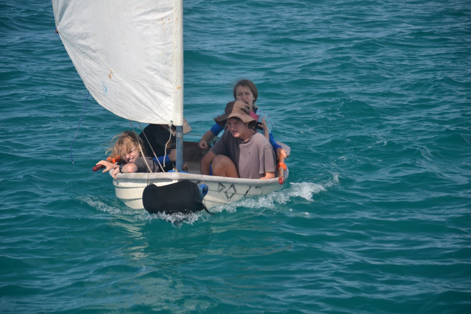
[Here is part 2 of 2 of Liz's letter home on our time in the Maskelynes and Havannah Bay]
 |
| Heading to "Hat Island" |
By Sunday, it was time to head for Efate to pre-position ourselves for
our flights in early July. We opted for an afternoon departure, and a
likely period of loitering in the wee hours of the morning, before
entering Havannah Bay at first light, for a final few days of relaxing
in solitude before the joining the hubbub of big-city life in Port
Vila. With the winds initially light, and the seas flat because we were
in the lee of Epi, we had a beautiful afternoon and early evening with
our full main and genoa; however, by the time it was dark and we were
standing 1-in-2 watches, we were wishing for our staysail. We can
handle the discomfort of a heeled boat under a furled genoa if it means
the off-watch can keep sleeping, but it sure made me appreciate that we
have begun to use our hank-on staysail (which keeps the boat steadier
and the center of effort lower) consistently! These are the lessons we
learn as we go. The entire narrow bay was still and calm in the gentle
light of early morning when we ghosted in, with the houses along the
shore reflecting perfectly in the water. The Bay had a bit of an odd
character to it after our time in the remote islands, as we were
anchored off the major ring road around the island, beside a series of
exclusive resorts, private homes, and restaurants; however, out on the
water, we still felt a sense of being in our usual separate world.
 |
| The restaurant was overpriced and under quality but the tree house was good. |
Our guide-book described 'the best hamburgers in Havannah Bay' at a
nearby restaurant, so this was our obvious pick for dinner, but we were
distinctly underwhelmed by our experience. The famous hamburgers were
not on offer, as all the bread had been fed to the fish by the
day-trippers from Port Vila, and when we chose a steak/fries combo
instead, we ended up with a steak with pepper cream sauce at more than
double what we had expected to pay; this place advertised 'cafe food'
but they charged 'restaurant prices'. When I resisted, the owner was
kind enough to make an adjustment for us, but although the food was
tasty, we felt that the ambiance did not warrant the prices being
charged. We learned later that most of their business is in the form of
bus-loads of people who stop as part of their tour of Efate. There is a
difference between tourist pricing and cruiser pricing!
We spent our first calm day at anchor doing boat jobs, including finally
fixing the wiring for our anchor/tri-light, which had worked itself
loose since it was installed in the Marshalls; it was fun for me to work
on this job together, and even to do the splicing, while Max did
another job in the saloon. It turned out that the grounding wire was
connecting intermittently, which explained why both the anchor and
tri-lights were acting up; I was able to re-splice the grounding wire
without having to cut the others as well.
In contrast to our experience of eating in Havannah Bay, our guided tour
was very memorable, and well worth the fee. This area of Vanuatu
became the first UNESCO World Heritage site in the country about ten
years ago, when three sites around the Bay were so designated in honour
of 17th century Chief Roi-Mata, who brought peace to the area after a
long period of warfare and in-fighting. Again, the majority of visitors
come by the bus-load from Port Vila, and are taken to the three sites
in a local fiberglass boat, but the Trust also makes arrangements with
yachties to go with a guide in their own boat. When we went ashore to
meet our guide, we were pleasantly surprised to find Richard, the
Chairman of the Roi-Mata Trust, waiting to take us around, rather than
one of his staff: we always love hearing stories directly from the most
knowledgeable sources :)
 |
| Richard and the "Tam Tam" he made. |
Roi-Mata became the most powerful chief in the region after bringing
together all the warring tribes for a peace ceremony: each group brought
something from home to represent themselves (eg octopus, yam, rock,
coconut, taro, banana, etc). Roi-Mata named each tribe according to its
offering, and invited each group who had brought the same thing to
gather and get to know each other as family. He also decreed that from
that time onwards, people could only marry outside their named tribe:
even to this day, Richard was able to tell us his Kustom name and the
names of his father's and mother's tribes. By requiring marriages to
occur across village and tribal lines, and by enforcing strict
gift-giving protocols, Roi-Mata was able to institute a lasting peace
amongst all the tribes and villages in the area. When he died as an old
man (after a solo visit to a neighbouring village - I didn't understand
from Richard whether suspicion was cast on that village or not, but
elsewhere I read that he was assassinated) he went to Lelepa Island to
'pray his last prays' at Fels Cave and then to another hat-shaped island
for burial. Apparently, the people didn't know how they would get his
body from the village to the eventual burial site, but then the waters
parted, and they were all able to process across the Bay. This struck
us as a bit farfetched until we thought of our own Sunday-morning
heritage, and realized that there may well have been a funny
conversation when the first missionaries came and told the local people
the story of Moses and the escape from Egypt: they would have exclaimed,
"That sounds just like what happened to Roi-Mata!!"

Richard took us first to the site of Magaasi Village, on the mainland
side of the Bay, where Roi-Mata had reigned as Chief. We were led up
the paths through the woods from the beach to the entrance to the
village, and shown the stones and shells along the way that would have
originally formed the borders of the paths and a sturdy wall where
Roi-Mata's bodyguards would have stood. Along the path, Richard showed
us certain large stones, which even now children are not allowed to
touch, that were believed to contain powerful magic to settle
grievances, change the weather, cause harm to enemies, etc. The stones
were set apart in clearings off the path, and were not to be approached
or touched by the uninitiated. The village is no longer inhabited, but
we had a sense of the importance of Roi-Mata from the way his living
area was set apart due to the change in elevation and the walls.
Richard also showed us a traditional tam tam, which is a vertical drum
carved from a hollow log: it stands in the form of a person covered with
intricate patterns, and is beaten with one or two heavy sticks. Tam
tams were used to enable communications amongst the far-flung
communities, with different rhythms having different meanings ("someone
has died", "come to a meeting", etc). When the message was heard at a
distance, it would be repeated on each village's tam tam until those at
the furthest reaches of the region had received the news (the method
reminded me of the 2nd story of the 101 Dalmations!). Although it
looked very old, Richard had carved this particular tam tam himself in
support of the development of the UNESCO World Heritage Site, basing his
work on traditional designs.
 |
| Benjamin teaching Richard how to do Minecraft |


Upon our return to our dinghy, we motored the short distance across to
Lelepa Island on the other side of the bay, and walked up a steep path
to Fels Cave. After Roi-Mata's ill-fated participation in the feast
with the other village (to which he did not bring his bodyguards)
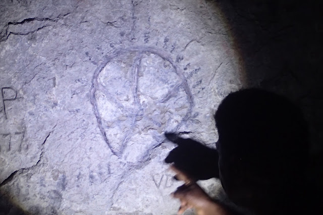
Roi-Mata went to Fels Cave to pray. We had the sense that the drawings
on the walls dated not only from the present and from Roi-Mata's time
(400 years ago) but from hundreds of years previously as well. The cave
was a high-ceilinged sacred space, and recorded some of the history of
the people and their chiefs, with marks on the walls to indicate peace
ceremonies, pigs exchanged, babies born, etc. Richard pointed out to us
that if we looked closely at the rock formations themselves, we could
see the image of a baby pig in the ceiling. Roi-Mata's body had briefly
laid in the cave, but there was a concern that his energy would taint
the cave after his death (and that his body would be stolen), so it was
important to his followers to move him to another location. They
weren't sure how they would do this, and this is where the parting of
the sea became important: they were able to move with their whole
contingent to Eretoka (Hat) Island, so-named because its topography is
so clearly reminiscent of a wide-brimmed hat, and all thanks to the work
of the Spirits who hover close-by. Even during our tour, Richard
credited the gap in the waves as we approached the beach in our dinghy
to the Spirits of his ancestors who were watching over us.

The third site was an optional part of the tour, but we were glad to go
there: we took Fluenta to Hat Island, sharing a lunch of fish, rice, and
pamplemousse, followed by Tanna coffee, while we were underway, and
anchoring off the north west corner of the island. Richard seemed quite
pleased to have gotten out of his office and aboard a yacht, and
excitedly used his smart phone to record a video of our transit to send
to a UNESCO colleague in Australia :) He hadn't been back to Hat Island
since he had done a post-Cyclone Pam survey in 2015, so it seemed
meaningful to him that he had the opportunity to visit as well.
 |
| Moon cycle |
 |
| Recording graffiti for later removal |
 |
| Graffiti from a missionary |
The burial mound was probably the most unusual site of the whole tour.
It was located in a clearing up a hill after a walk along the beach.
Not only was Roi-Mata buried here, but many of his followers and
bodyguards were as well. At a certain number of days after his death,
they held a ceremonial feast to mark his passing and then upwards of 50
of the followers were laid down on a second layer of the grave,
including one of Roi-Mata's wives who was laid beside him, and one of
his small children who was buried at his feet. My understanding is that
this feast took place 100 days after his death, as part of the
traditional/ceremonial grieving process, and part of the ceremony
involved dancing on the grave site to tamp down the dirt before the
followers and bodyguards were placed on top to literally follow Roi-Mata
into the afterlife. It seems that a significant amount of kava might
have been part of their feast (and their willingness to sacrifice
themselves). Richard told us that for hundreds of years, the site of
the burial, which was taboo to visit, was kept clear of stray grass and
leaves by the winds and the Spirits, but that after the ground was
disturbed by an archeologist in the 1960's things weren't the same, with
the grass and leaves having to be kept from the site manually, although
now that the site is a UNESCO World Heritage site, and it is maintained
with respect, the power of the Spirits is beginning to return.
Regardless of the presence of magic at the site, or not, it was sobering
to see the two grave markers for Roi-Mata and his wife, surrounded by
shells and decorations, including his huge conch shell, and to see the
ring of stone markers for each of the followers and body guards that
formed a kind of fence around the area. Richard spoke sacred words in
his traditional language to let the Spirits know that we had come from
Canada to visit, and he thanked them for our visit when we left.
 |
| The Roi Mata burial site |
 |
| The Roi Mata burial site |
 |
| A photo we took at the National Museum showing the Roi Mata skeleton following the excavation |
We spent most of our time in Vanuatu as the only boat in the anchorage,
with a few stretches were we were with one or two other vessels. We
were thrilled the following morning to look out from Fluenta and to see
that the catamaran which had arrived during our Roi-Mata tour had two
boys onboard! I sent the three kids over in the dinghy to say hello,
and we didn't see them for the rest of the morning, as they were quickly
welcomed aboard to play and visit. Two dads had come away on a
one-month holiday with their boys, after one of the dads had bought the
boat as a charter vessel; they were enjoying their last few days in
Vanuatu before flying home to California. In the instant-friendship
style of cruisers, we spent the afternoon snorkelling together and the
evening on the catamaran watching a movie, before travelling together
across the bay to what became one of our favourite anchorages in
Vanuatu, tucked into a little nook at the north-west corner of Lelepa
Island. Even with satellite imagery and GPS waypoints, it was a tricky
(humbling) bay to enter and depart, and there wasn't much room for
anyone more than the three boats who ended up sharing the space (our
friend Phillipe on Blue-Bie was there too), but it had a lovely beach,
trails to hike, and a little low-key resort ashore that welcomed daily
banana-boat loads of tourists during the week for day-trips out of Port
Vila; we weren't much bothered by them at anchor, and it was all-quiet
from mid-afternoon after they left, clearing the beach for yoga and
sundowners. The caretakers even helped the boys to light a fire to burn
some coconut husks (which was old-hat for Johnathan but seemed to be a
'first' for the visiting boys). As for us, we felt like we were 'back
in Vanuatu' when two ladies came by our boat in a sit-on-top kayak to
see if we needed anything; the next morning (Saturday) the one
Presbyterian lady came back with her husband to trade sugar and coffee
for fruits and vegetables while her Seventh Day Adventist friend was at
church. As with Richard, they seemed thrilled to be welcomed aboard and
offered a cup brewed Tanna coffee, which seemed a big change from their
usual instant fare, and there were big grins all around when we sent
them off with one of our very-tired folding cockpit chairs :)
All too soon, it was time to weigh our anchor in paradise to head for
Port Vila, and the maintenance and travel arrangements that awaited us
there. The kids and I spent a month in Canada, while Max had a month in
his own company, doing innumerable boat jobs, and even having some
afternoons to go kiting.
Whew! This seems long-winded and overdue, but I have finally caught you
up on our pre-Canada movements, now that we have returned to the boat
and arrived in New Caledonia. You have likely already seen photos of
our extraordinary visit to the volcano on Tanna Island (think orange
lava and rumbles that shook the earth), and stay tuned for news of our
reunion with Honey (joyous) and our adventures in New Cal (think cold
and windy - it is winter here, after all!)
Much love from Fluenta,
Elizabeth
-----
At 2017-09-03 10:39 PM (utc) SV Fluenta's position was 22°16.69'S 166°25.76'E