Saturday, 19 November 2016

Inclearances, outboards, and more fish!

A lot of meals for the family


Greetings,

Just when I think we will have a day that doesn't "give us much to write home about" something interesting happens. Such was the case today.

We went to bed under clear but turbulent skies; we woke in the wee hours to shut every hatch and window in what we thought was a squall but turned out to be a big system that dumped rain and blew 25 kts on and off for the rest of the night. The funniest moment for me was leaping up the companionway stairs to untie the wind scoop on the starboard side in order to close the saloon hatch; it had been tied by Johnathan, who loves to climb the rigging, and it was all I could do in the wind and the rain (and the middle of the night needing to pee) to reach the knot to release it from the shroud. The rain was just starting to come down heavily, and it sounded like pellets landing on the water around us. It quickly became the kind of downpour that drenched me by the time my small task was accomplished; on the bright side, in the 30-deg heat, being soaking wet was cooler for sleeping! Since Johnathan had been sleeping in the cockpit, he was awakened as well, so between him, Max, and me, we quickly battened the hatches and got everything closed up. Later in the night, another squall caused the rolling hitch on one of our snubbers to release, so Max had his own gymnastics evolution to reach beyond the bow roller with the anchor hook to replace it, again in 25 kts of wind. I tell you this story just in case you think we lead a glamourous life ...

It was still raining in the morning, so we elected Max as the family representative to go ashore for the last two stops on our Tuvaluan clearance circuit. When he came back, he described meeting people who were friendly, but rather baffled by the whole idea of someone coming to Tuvalu in a yacht and therefore needing to clear in. In his search for the Customs officer, whose office was unmaned, he asked several people and finally found himself being given a ride by a stranger (recruited in rapid-fire Tuvaluan by the kind Marine office lady) from the Customs office nestled into the sea of sea containers to the main Government office building, where he happened upon the harried customs officer, his hands full of files, in the foyer. They arranged for Max to come back to the Customs office later in the afternoon, and in the meantime Max wondered how he would get to the Health office at the hospital to clear in there. When he asked for directions, someone introduced him to the Medical Officer for the entire area, who was just on his way there with a driver in a 4x4, and was more than happy to give him a ride. As he was walking back to the Customs office to retrieve the dinghy and come to Fluenta for lunch, the same scooter that had taken him into town picked him up and took him the rest of the way.

Shortly after Max came home and regaled us with this adventure, a longboat came by full of fish. We think the five men aboard were from the town, but as none of them seemed to speak English, we couldn't be sure. They gave us a Pacific Bonita (a kind of Tuna). I am sure that they would have given us more, but we gestured emphatically that one was plenty:) We gave them one of our bags of meat from the Sailfish, and showed them our Mexican 'Fish of the Pacific' photo card so they would know what it was. It was lovely to be welcomed like this, especially since I haven't even set foot ashore yet! Interestingly, the fish was frozen, so we think all the fish came from one of the big Chinese/Korean fishing boats that are anchored here in the lagoon.

After a quick lunch, Max went to meet the Customs officer, and was ready to head back to Fluenta within 15 minutes, with Fluenta officially cleared into Tuvalu. We had no idea how quick his meeting was, however, as he didn't return until almost an hour later! The pull cord detached when he went to start the engine, so he rowed the 2.5 km back in the RHIB. Let's just say that this boat is not designed for speed under oars. Well-cooked after his exertion, as by this time the the rain had ended and the sun was blazing, he spent the next while with a glass of water and our 1" thick Yamaha manual; this will be the first job on the agenda for tomorrow morning.

The kids and I had a productive day as well. We have been in possession of a "Brave Writer" language arts package for almost a year without much engagement, but today we did the first of our "Friday Freewrites". I can't say that the exercise was met with a lot of enthusiasm, but at least both kids completed it, which was my only goal. Our aim is to do a Freewrite every Friday for eight weeks (ie they will write for a set number of minutes on any topic they like, keeping their pencil moving the whole time). They can read them to me, or not, and then I will I put them away in a folder. At the end of eight weeks, we will look at all their sheets and see if there is one piece that they would like to polish; if so, we will do some revision, if not, we will carry on with some more free writing. We have been doing 'Tuesday Poetry Teatimes' already this term, but they will take a backseat for the next eight weeks and we will focus on the writing side of things.

The rest of the day was very peaceful. By the time I woke up this morning, Victoria had set bread to rise and was finishing her Life of Fred math chapter for the day. In the midst of the post-passage stowing and sweeping that I was did once I got going, Johnathan (and sometimes Benjamin) managed to play with Lego on the saloon floor, mostly games of good guys and bad guys. The soundtrack of this play regularly gives me a chuckle, both for the detailed special forces lessons that Johnathan imparts to Benjamin (I am sure that every two year old is getting lessons in sniper rifles and anti-aircraft guns, yes?), and for the insults that fly when Benjamin acts his age (2) instead of Johnathan's (11) (J: "No you knucklehead, not like that" / B: "I'm not a knucklehead (or what ever insult he has just received) I am Benjamin-George-Shaw-Brown"). Benjamin is learning early to stand up for himself! Insults aside, it gives me joy to watch all three kids spend so much time together, expressing opinions, sharing their belongings, and collaborating on their ideas. Without even knowing it, they are practicing vital skills of negotiation, patience, teamwork, and cooperation. (Of course close quarters also breeds its share of squabbles, insults, and raised voices ... which returns us to the need for negotiation, patience, teamwork, and cooperation!!)

Of course dinner tonight was fish, in this case, seared sesame-soy tuna with rice and Asian slaw (Thanks again, Deanne, for the Boat Galley cookbook!) followed by Banana Cake (Joy of Cooking app) using the last of our well-past-ripe bananas from Savusavu. We will have fresh fish for a few more days, and I put four massive bags of sailfish in the freezer this evening for later in the season. Max is going to turn down the temperatures of the fridge/freezer tomorrow as now that we have moved north, the freezer isn't quite keeping the food at the extremities of the box frozen. This will cost us power, but save our food from spoiling.

We are hoping that the rain will stop and we will all go do some exploring tomorrow.

Love to all,
Elizabeth
-----
At 2016-11-17 11:33 AM (utc) SV Fluenta's position was 08°31.52'S 179°11.32'E
-----
At 2016-11-17 3:22 AM (utc) SV Fluenta's position was 08°31.49'S 179°11.30'E

----------
radio email processed by SailMail
for information see: http://www.sailmail.com

Thursday, 17 November 2016

Anchored at Funafuti

Hello,

We had a beautiful last night on passage. At sunset, it looked like we would have lots of squalls (in fact the not-so-super moon was well into the sky before we could even see it, because the clouds were so thick on the horizon), but then most of the unsettled weather moved off without materializing. On my watch, the sky was clear and the moon was radiant to windward. On Max's watch, he had quite a sound and lights show with lightening that brightened the whole sky, but thankfully it stayed far from Fluenta. Each time we did the calculation for when we would have to motor, the wind had changed so that we could do another three hours of sailing. Finally, just after dawn, as one of the few squalls to hit us gave us strong winds on the bow, we started the engine and motored the last few hours to the pass. As the squall moved away, it took all the wind with it, so we had lovely calm seas and sunshine for the last short leg.

The pass into Funafuti was plenty wide, which was good, because the gentle seas actually produced quite a surging, rolling swell at the pass itself. It felt on the bow as if we were galloping into the pass, but we actually had about 1.5 kts of current against us (which we prefer, because it provides more control at the helm for less speed over the ground) and Max controlled the helm with no sense of turbulence.

Speaking of current, we are hoping that we have a strong current with us on our passage south next year, as we felt like we paid our dues this week: we spent most of the last 48 hrs of the trip with over a knot of current either against us or pushing us laterally. At first I thought it was a tidal current, but when it went on for six, then 12, then 24 hours, it was pretty evident that it was an ocean current! Oh well. We made good time regardless, but it was a bit disheartening to have a boat speed of just over 3 kts and a speed over ground of 2 kts at certain points!

We had hoped to be at the "5 miles offshore" mark mid-morning in order to go through the pass around noon, and cross the lagoon with the high sun behind us, and this is exactly what happened. We couldn't have planned it better, from the winds that helped us track along the rhumb line for most of the passage, to the speed of advance that was just enough to let us sail right until this morning (the winds were forecast to die at least 24 hours earlier than they did). We had one lumpy day, but the rest of the passage was smooth and calm. I have decided that I prefer to be a bit of a fair-weather sailor, so for me, these conditions were ideal :)

After an uneventful crossing of the lagoon (thanks, Deanne for the Cruiser Notes!), we anchored off the capital (Funafuti) at around lunch time. We have friend whom we believe are enroute from Vanuatu and due in the next few days, but at the moment, we are the only cruisers here. There are a number of large fishing vessels in front of the commercial dock, and it is unsettling to think of how big their catches are when they go out. I suspect that sustainability is not at the top of their priority list.

By the time we had eaten and launched the dinghy, it was clear that Benjamin was in no shape to go out in public, so we decided that Max and the big kids would go ashore to clear in and I would settle Benjamin for his over-due nap.

In addition to clearing into Immigration and Quarantine (leaving Customs and Health for tomorrow morning), Max was able to sign us up for 3G Internet. We had heard from our friends that Tuvalu had introduced this service last season. They have, but it turns out to be amongst the most expensive we have seen: $10 AUS / 100 MB. At this rate, it would be $800/8GB, for which we were paying just $25 FJD a week ago. We will take care of necessary business, but we won't be browsing or watching videos!

Dinner tonight was a massive bowl of Sailfish ceviche, with limes from Taveuni (thanks Granny & Grandpa) and the last of my cilantro from the Savusavu market. In Mexico, we used to enjoy smoked Marlin ceviche, and even without being smoked, this was very good :) I also cooked some rice and fish to have as a second course, but we were so full from the ceviche that now we have lunch for tomorrow. I am grateful that I won't need to cook after all, as it was 33 deg C in the saloon and the cockpit when we arrived at noon today!! I said when I left Canada that I wanted to sail in the warmth, and it seems that I have gotten my wish :)

We are not sure how long we will be here, but we are looking forward to exploring a little and relaxing for a few days before we head north again.

Love to all,
Elizabeth
-----
At 2016-11-17 9:02 AM (utc) SV Fluenta's position was 08°31.51'S 179°11.35'E

----------
radio email processed by SailMail
for information see: http://www.sailmail.com

Wednesday, 16 November 2016

Fishing Drought is Over

Greetings!

We don't get many days much better than today.

The winds were predicted to drop off all morning, but the kids and I managed to keep the boat moving right through until after lunch (moving being loosely defined as a boat speed above 2 kts and the sails drawing ..). The water and the sky were both glorious shades of blue: a deep aquamarine for the sea and a rich royal blue for the sky. We used the slow speed as an excuse to do some real-life math: how many hours could we sail at 3 kts before motoring at 6 kts in order to arrive mid-morning tomorrow? Using her own iterative approach, Victoria determined that we could sail for about 10 hours before motoring; as it turned out, the wind kept cooperating, and we kept delaying when we would start the engine.

Max took over the watch in the early afternoon, and I settled in for my nap. Long before I expected to be woken up, I was shaken with one word: "Marlin!" We last caught one of these huge fish in 2014, and here we were again with another on our lure. (Max will have to add the technical details of the lure for the fishing aficionados...) I quickly went upstairs and found that Max and the kids had furled the genoa and Max was bringing in the port line hand over hand onto the yoyo. I tried to see the fish over the side deck, but it turned out that it had swum behind Fluenta. Just as I suggested to the kids that they bring in the other fishing line, we realized that he had hooked one lure and tangled the other! It was extraordinary to see this beautiful fish swimming in the clear blue water and flashing in the sunshine.

Bringing the fish onboard turned into a family affair. (Thankfully, Benjamin's role was to enjoy the last 10 min of his nap downstairs!). Victoria and Johnathan were on camera and knife-fetching duties. Learning from the mahimahi who got away earlier in the passage, and given the massive size of this fish, we used our gaff for the first time in several years (we usually bring fish aboard by hand with the big fishing hooks and heavy line). I normally just watch as Max brings the fish aboard (my job starts when the fish reaches the galley), but since Max couldn't both hold the line and gaff the fish, and there was *no* way that I was going to try out my luck with the huge fish and the gaff, that left Max on the gaff and me holding the fishing line. The fish had done some big dives and diversions as Max was reeling it in, but now at the side of the boat it was surprisingly calm, and Max was able to gaff it without too much difficulty. Still, it was so big that on the first attem
pt to bring it up, the bill got caught in the bimini frame behind him, and Max had to heave a second time to land the fish. In what seemed like ages, but was in fact a matter of seconds, the massive fish was flopping on our deck and Max was calling to Johnathan for the knife. Next it was time for Victoria to bring out our fish chart and identify our catch. We knew it would be either a marlin or a sailfish, and one look at the dorsal area confirmed that we had a massive sailfish on our deck: once measured, it was 83" (2.1m). We tried to weigh it, but we broke our luggage scale; Max guessed it to be around 75 lbs. Benjamin's eyes were bulging out of his head when he came up from his nap to see what was on the deck!

We finished the day with seven large bags of fish in our fridge and one yummy dinner in our tummies :) Ceviche is on the menu (using Granny's limes from Taveuni) tomorrow.

Now, as we approach midnight, the messy squalliness that threatened at sunset has turned into a clear sky and gentle (8-10 kts close reach) sail. We will likely motor eventually to get to Tuvalu, but we are not motoring yet :)

Love to all,
Elizabeth

-----
At 2016-11-15 12:02 PM (utc) SV Fluenta's position was 0929.57'S 17918.27'E
-------------------------------------------------

Tuesday, 15 November 2016

Enroute Tuvalu under the Super Moon

Greetings!

I had a long-overdue "catch up" email started before we left Fiji ... but it will continue to be long overdue, and I will use these few moments between the everyone going to sleep and the (likely) squally period to send a quick update on this passage.

After a lovely visit with Max's parents in Taveuni and a few days of the usual pre-passage maintenance and provisioning, we cleared out of Savusavu late last week and are now making our way towards Tuvalu.

Our first day out of Fiji saw us motoring and then sailing on glassy seas under a brilliant blue sky, which gave us a chance to use the last of our Internet for phone calls and music downloads before we had to hunker down and reestablish our sea legs the following day. Let's just say that no one (especially me) really felt like spending much time down below either at the chart table writing emails or in the galley cooking. Thankfully, I had prepared extra food during the calm period the first day, so we had rice and pasta as well as the usual crackers and cheese. Today was somewhere in between (the sea state has calmed and not only did I manage to cook dinner, but I used some of the ripe-all-at-once bananas we have aboard to make dessert as well).

We are back into squall territory, so I suspect that the lovely 8-11 kts and calm seas will be disrupted after midnight as it was last night, but for now, it is the sailing that I love - calm seas, light winds, and the brilliant moonlight to keep me company. We have started a pattern of Max taking the afternoon watch and going off-watch at around sunset, so I had a nice evening chat with each of the kids before they went on their own time to sleep. Even Benjamin is below, sleeping on the port bench with a lee-cloth (although I went down at one point and his head and one arm had found the only gap between the cloth and the frame of the bunk. Yikes! He is scooted back into a better position now, and there is a fan over his head to keep him cool.)

This is our first long passage since our Niue-Tonga leg in 2014 that we have just the family onboard. As much as I like standing 1:3 watches more than 1:2, it is really nice to be just the five of us. Victoria and Johnathan are really capable, and they regularly give us catnaps during our watches; it won't be long before they have an official "watch" of their own. They watch for traffic and squalls, grind the winch (especially when we need to furl the genoa for squalls), play with Benjamin, and keep themselves occupied. Victoria has been crocheting an afghan, square by square, following instructions in a book that was in my grandmother's cupboard and that Aunt Margaret passed along to her when we were home in the summer. Johnathan has been continuing to research and write his book (a project begun out of the boredom of six weeks in the van when we were camping in NZ last season). Benjamin has divided his time between asking for turns on the iPad so he can build things in Minecraft (yes, really) and asking for turns with Johnathan's Lego. Did I mention that the big kids are really patient?! We bought a little DVD player when we were home in Canada, and I have to admit that I am grateful for the amount of time he will spend watching Octonauts and other little shows that we have put on a memory stick for him. I agree with all the research that says screen time should be limited for little people, but I sure appreciate the quiet time when he is occupied!

We are loving the full moon each night - it was about 99% and still waxing our first night out, and we think we have one more overnight after tonight, so we couldn't have timed it better. We will enjoy the stars at anchor as the moon wanes, but (especially since we haven't been off-shore in a while) it is really nice to have the light of the moon by which to see the squalls this week!

We wound in the fishing lines at dusk tonight because we caught one of the biggest fish we have seen last night and had to throw it back - we caught a barracuda that was well over 50 lbs. We would have eaten it in Mexico, but in the South Pacific, they are risky for ciguaterra, so it had to go. Barracuda seem to be the only fish biting in the dark, so now we will just bring in the lines after sunset. We are still waiting for something tasty to bite the hook. We snagged a beautiful mahimahi on our way out of Savusavu, but it didn't have the hook in its mouth, so it got away when we tried to bring it aboard. We have had them come back for the lure, but this one was obviously a bit smarter than our previous catches and it swam well away from us!

We are all well and looking forward to arriving in another day or so at Funafuti, Tuvalu to start our north-bound cruising season.

Love to all,

Liz
-----
At 2016-11-15 1:02 PM (utc) SV Fluenta's position was 11°01.33'S 179°23.48'E
-----
At 2016-11-15 1:02 PM (utc) SV Fluenta's position was 11°01.33'S 179°23.48'E

----------
radio email processed by SailMail
for information see: http://www.sailmail.com

Friday, 11 November 2016

Using Satellite Imagery to Assist Navigation - SAS Planet

Most of our blog posts are of the "show and tell" variety of our day to day life cruising full time as a family.  This is one aims to be a bit different in its purpose to show how we use satellite imagery to assist with navigation in the South Pacific.

DON'T BELIEVE EVERYTHING YOU SEE ON THE SCREEN

If you start sailing in places like the US/Canada, Australia/NZ or Europe, you can quickly get lulled into believing what is shown on your laptop, handheld GPS or chartplotter.  Looking at a chartplotter that shows which slip you are on in the marina is pretty impressive.  Move beyond those areas, however, and four issues quickly are revealed :

- Not everything shown on the chart is actually there:   We regularly see Aids to Navigation that have long since drifted away
- Not everything that is actually there is charted:  Many of the vector charts of the Tuamotus are based some sort of analysis of satellite imagery but many of the bommies (coral heads) are either not shown or shown as being "safe" depths when they certainly are not.  In other areas, the critical passes are stick-like cartoons without enough data to use for navigation or to decide whether it is safe to try the pass.
- Selective display of information in vector charts: lots about this is written elsewhere and was a leading cause factor of the Team Vestas grounding on the last Volvo Ocean Race (report here).  As you zoom in and out on vector charts you can see atolls appear or disappear.
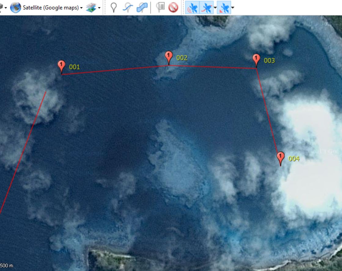
- Datum error: most of the these excellent cruising grounds were surveyed well before GPS. Therefore, even though the geometry of all the features can be accurate, the position of the charted objects may be shown in the incorrect position on the Earth's surface.  You can use radar to estimate the datum error but you need to be aware that each surveyed area will have a different datum error.  If you want to read more on this here is one starting point: http://www.shipwrite.bc.ca/aboutgps.htm


Here is a 1:625,000 zoom showing the approach to Tahanea in the Tuomotus.  Lots of sea room to the south east ...

Until you zoom only one level in to 1:500,000 and the atoll of Motutunga appears

Motutunga circled in red.  This issue was one of the cause factors in the Vestas crash.

The little grey box gives a hint that an atoll is hidden there.

Of course, once you get there there may not be a lot of data.  This is a close up of Tahanea in CMap

The charts for the passes are actually pretty good at this atoll

Navionics has more detail on this atoll than C-Map but the some of the bommies that are marked are not there and some of the spots shown with 16 feet of depth are actually much shallower.  It is suspicious when every bommie is 16 feet deep on the chart ...


Okay, we are not sailing over Isla Isabela in Mexico at 7.7 kts.    The datum for most of the Pacific coast of Mexico is off by a fair margin.  We used the Garmin handheld for our first two years of cruising before we treated ourselves to a little chartplotter. (Pictures of Isla Isabella here: http://sv-fluenta.blogspot.com/2012/12/feliz-navidad-from-la-cruz.html)

TOOLS TO MITIGATE THE RISK

The first and foremost way to mitigate these risks is the Mk1 Eyeball and carefully timing when choosing to pass through critical areas.  We try to ensure we go through passes between 1000 and 1400 and, ideally, with the sun behind us so we can see the reefs.  During these times, someone is always on the bow watching (clipped in if the pass looks rough).

That was our main strategy through French Polynesia but last year in Fiji - a cruising ground famous for its yacht-grabbing reefs - we also started to use SAS Planet to download, store and analyze satellite imagery.

It is certainly not the only tool out there.  Many have had great success with OpenCPN (which we also use) and GEKAP but we have not put the time in to getting it running yet.  We also OVITEL Maps on the iPad as it allows us to have a picture in the cockpit but we have not been using it as much, as it can be a bit finicky to use and the iPad is too hard read in the bright sun (and too bright on night watches !)

HOW WE USE SAS PLANET

Download data

Select the area you want to download.  You can do this by scrolling over the area at the desired zoom levels as you would with Google Earth or you can use the polygon function to select an area.


Once the polygon is selected you can open the selection manager (the green "check mark") and pick what zoom levels and which map source you want to use.  In Fiji we usually use Google, Bing and/or Nokia. Sometimes a big cumulus cloud is over the critical part of a pass or anchorage so it is nice to have alternatives.


Once the data has downloaded it is saved in the cache.

Route Planning

The rest of the process is personal preference and based on your assessment of the risk.  I generally plan routes in Coastal Explorer on the laptop and then export the route as a KML file.

In SAS Planet this file can then be imported from the "Placemark Manager" and you can see your route and any marks you imported overlaid on the chart data.  At this point you can then check the route, at a detailed level remembering it is vector data, to see if there are any hazards.

If there are hazards along the route that the regular charts do not pick up, I can then amend the route either directly in Coastal Explorer or by reversing the export/import process from SAS Planet to Coastal Explorer.   If particular hazards are noted, those can be marked on SAS Planet and exported to Coastal Explorer and your chartplotter. I do this especially if there are particular hazards in a pass.  Also, for very tight anchorages, it is nice to pick an anchor-spot ahead of time to ensure adequate swing room.

The island of Yadua (http://sv-fluenta.blogspot.com/2015/09/yadua-in-photos-plus-repairing.html) in Fiji is a good example.  Here is a route drawn with Open CPN into the western anchorage.  Looks good until you export it to SAS Planet and find out that you would drive over the reef.  In Google Earth you can see the entrance but not the the southern anchorage.  With Nokia it is clearer on this occasion.

The western approach drawn in Open CPN

Oh, except when you export it to SAS Planet you see you would have driven over a reef.

By using Nokia instead of Google in this case the southern part of the anchorage is visible as well.


The other side of Yadua provides another example.  It is a beautiful anchorage near to a friendly village and excellent spearfishing ( see http://sv-fluenta.blogspot.com/2015/09/spearfishing-school.html).  The entrance and anchorage are a bit tighter though.

The entrance to the eastern anchorage in Coastal Explorer.  Note that the two red Aids to Navigation shown on the chart are not actually there.
When you look at the SAS Planet data you see two bommies in the pass that are not marked on the chart.

In this screenshot, you can see two danger marks put on the bommies as well as a possible spot to anchor with sufficient swing room

and then this can be imported back into Coastal Explorer and the chartplotter.


CAVEATS

- No tool replaces the Mk1 eyeball and commonsense
- Just because Google Earth shows there is open water, it does not mean there necessarily is just water there.  To save on data, some areas are shown as open water where there are actually reefs.
- This is certainly not the only way to do this - there are lots of other tools.


Always look where you are going !  If this was a pass transit Liz would have her PFD/tether on as well.

Worth it once you get there (Fulaga, Fiji)

Worth it once you get there (Tahanea, French Polynesia)


Tuesday, 8 November 2016

Where in the world is Fluenta - How to find Fluenta


This season we have been spoilt with increased comms capability with our Iridium Go.  We are still connecting at about 2.4 kb/s or about 1/20th the speed of old 56 k dialup (or 1/800th the speed of broadband) but it is much more consistent than the HF radio.  With this device there is also a tracking function that you can access at:  http://forecast.predictwind.com/tracking/display/Fluenta

We will continue to use the Yachts in Transit site on an occasional basis as we can add comments and weather data as well as because the authors of the site provide weather advice to the cruising fleet.  David and Patricia provide an amazing service to the fleet with their daily weather discussion.

As in previous years, a reminder that if you notice that the tracking is not working to do not revert to "panic stations".  There are all sorts of technical and operator issues that could cause the systems to not work.  If we do have an actual emergency we will activate the EPIRB or PLB(s), use the SOS buttons on the Iridium Go and/or call RCC directly.

A screenshot of the Predictwind tracking site.

A screenshot of the Yachts in Transit site.

Monday, 7 November 2016

Visiting Granny and Grandpa - Taveuni, Diwali, Waterslides and Ping Pong

My parents spend part of the year in Taveuni so we met up with them again in Savusavu and sailed over to Taveuni.  First stop was the lovely, and just rebuilt after cyclone Winston, Paradise Resort. The next day we sailed up to the north of Taveuni so my parents could pick up their truck and open up their place on the hill.  The kids lived ashore and helped at the house while Liz, Benjamin and I commuted back and forth daily.

Family Photo at my parent's place.

Granny leads the charge swimming to shore with the kids.

Paradise Resort - Amazing how they have rebuilt after Cyclone Winston

Paradise Resort - Amazing how they have rebuilt after Cyclone Winston

Benjamin enjoying the pool at Paradise.

Poolside parking for Fluenta

Benjamin surveying the grounds


Johnathan sampling Grandpa's crop.

Victoria surveying Grandpa's crop.

Geography field trip - the dateline.

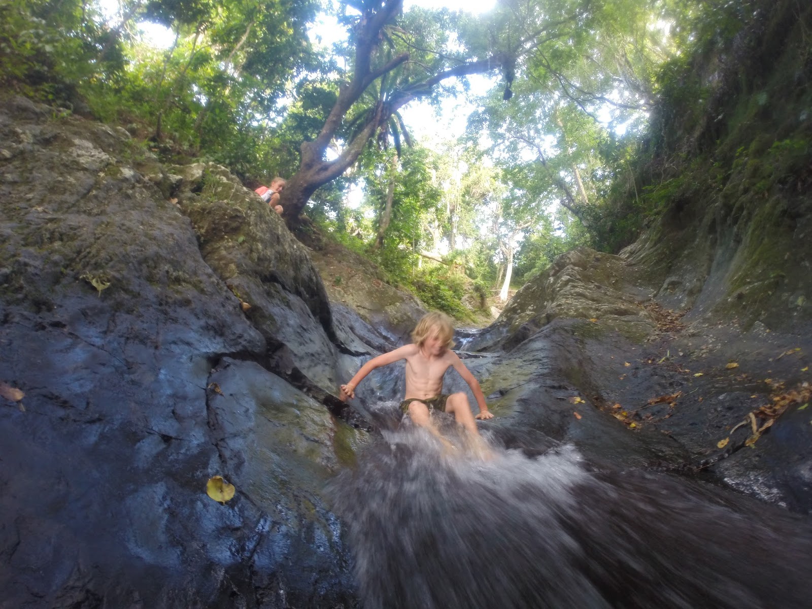
The waterslide.  Less water than last year but still fun.

Zoom

Zoom.

My turn

Of course, the local kids go down standing up.

We were honoured to be able to share Diwali with my parent's neighbours.

The ladies at Diwali

Some Diwali kava.

The "road" to the house.

Fun at one of the restaurants.

Granny teaching ping pong.